Drone Imagery Aerial Survey Inspection
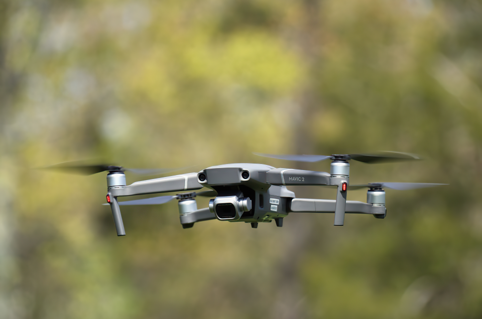
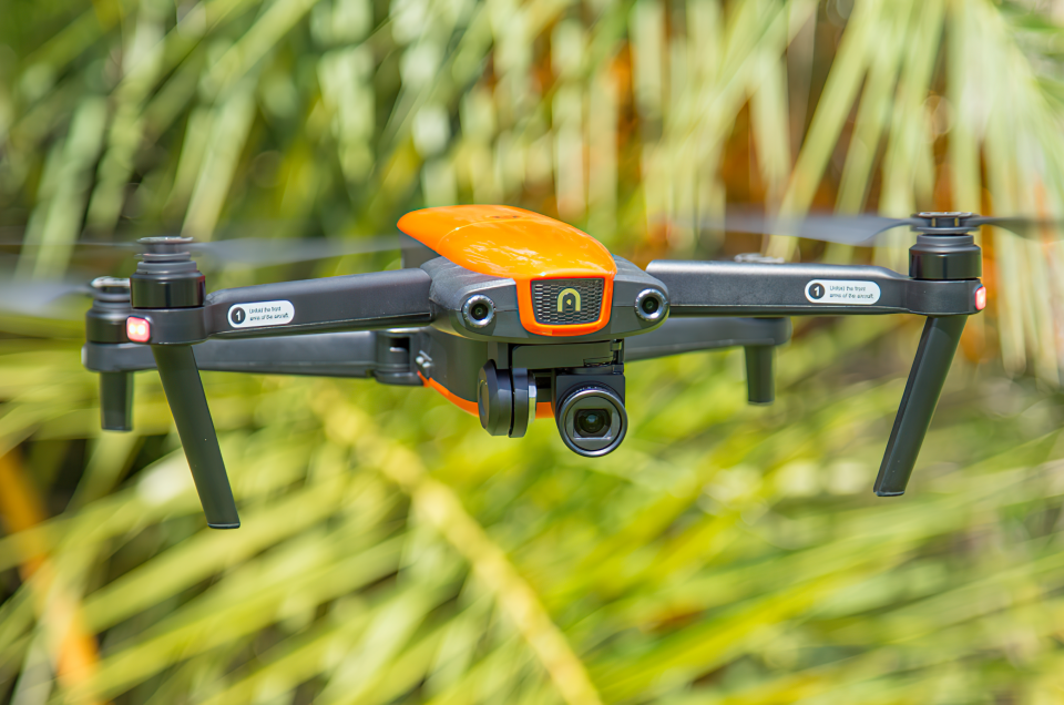
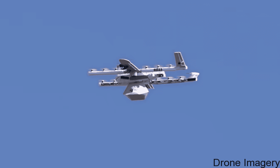
Firstly, Drone Imagery have significant experience in flying multi-rotor and fixed wing Unmanned Aerial Vehicles (UAV’s). Technology today gives the ability to deliver high detail 4k UHD aerial filming, commercial survey inspection, high resolution photography, mapping, thermal imaging and 3D modelling.
Secondly, Drone Imagery are fully licensed by the Civil Aviation Authority for commercial use.
Thirdly, our advantage in comparison to other conventional operators is that we have Civil Aviation Approval for Night Flying Operations.
Importantly, no matter the conditions, with Drone Imagery’s all weather ability (Sub Zero, High Wind) we can ensure an interruption free project.
Moreover, our equipment includes the DJI Inspire equipped with a 4k ultra high definition cameras. These are the latest High Detail DJI/Flir XT Thermal Imaging camera, seek & search facility with 3D Thermal Modelling capability.
Drone Imagery
In Conclusion Drone Imagery, have all the necessary Skills & Equipment to facilitate a stress free project. Above all safety is one of our primary concerns in addition to executing the project in a timely manner.
Drone imagery involves the use of unmanned aerial vehicles (UAVs) equipped with high-resolution cameras and sensors to capture images and videos of a specific area from above. This technology has emerged as a powerful tool for various industries, including real estate, construction, agriculture, and environmental management.
One of the primary benefits of drone imagery is its ability to provide a bird’s-eye view of a specific area, which can be particularly useful in the real estate industry. With the ability to capture stunning aerial images and videos of a property, real estate agents can showcase their listings in a more engaging and immersive way. This technology can also be used to capture panoramic views of a property’s surroundings, providing potential buyers with a more comprehensive understanding of the area.
Drone imagery is also being increasingly used in the construction industry, with roof inspections, site inspections. With the ability to capture detailed images and videos of a construction site, architects and builders can monitor progress, identify any issues, and make informed decisions regarding project management and coordination. Additionally, drone imagery can be used to create 3D models of construction sites, providing a more realistic and immersive perspective.
Agriculture is another industry that has benefited greatly from drone imagery. With the ability to capture high-resolution images and videos of crop fields, farmers can identify areas that require attention and make informed decisions regarding irrigation, fertilization, and crop management. This can result in higher crop yields, reduced costs, and improved environmental sustainability.
Drone imagery can also be used for environmental management and conservation efforts. With the ability to capture detailed images and videos of natural habitats, scientists and conservationists can monitor ecosystems and identify areas that require protection. Additionally, drone imagery can be used to monitor wildlife populations and track changes in habitats over time.
At our website, we aim to provide you with the latest news, insights, and information on drone imagery. Whether you are a professional in the industry or simply interested in learning more about this technology, we have the resources and expertise to help you stay informed and up-to-date.
Drone Imagery
Elevating Your Vision with Aerial Photography and Videography
Welcome to Drone Imagery, your premier destination for cutting-edge aerial photography and videography services. We are dedicated to providing exceptional drone services that capture breathtaking visuals from above, offering unique perspectives that transform ordinary scenes into extraordinary masterpieces. Whether you need stunning aerial imagery for real estate, marketing campaigns, surveying, inspections, or cinematic storytelling, our team of skilled professionals is here to fulfill your every need. Discover how Drone Imagery can elevate your vision and take your projects to new heights.
Aerial Photography: Capturing the World from Above
Our aerial photography services offer a bird’s-eye view that unveils a whole new dimension of beauty. From sprawling landscapes to architectural wonders, we harness the power of drones equipped with state-of-the-art cameras to capture high-resolution images that leave a lasting impression. Our skilled drone pilots and photographers work in perfect harmony to ensure precise control and breathtaking shots that resonate with your audience.
Drone Photography: Elevating Your Vision to New Heights
Drone photography is the art of capturing moments from angles previously unimaginable. Whether you’re planning a wedding, a special event, or simply seeking stunning visual content for your business, our drone photography services guarantee images that stand out from the crowd. Our team’s creative eye and technical expertise result in visuals that exude professionalism, uniqueness, and elegance.
Drone Videography: Unleashing the Power of Motion
Our drone videography services transport your audience into an immersive experience like no other. With the ability to capture smooth and dynamic shots, we create captivating storytelling that captivates viewers and leaves them wanting more. From promotional videos to documentaries, real estate tours to event coverage, our drone videography elevates your vision to new heights of excellence.
Aerial Videography: A Visual Symphony from Above
Aerial videography offers a symphony of moving images that leave a lasting impression on your audience. Whether you require marketing videos, corporate videos, or creative projects, our aerial videography services enhance your storytelling capabilities. Our skilled team of pilots and videographers ensure a seamless blend of artistry and technology, delivering videos that surpass expectations.
Drone Services: A Diverse Range of Solutions
At Drone Imagery, we offer a diverse range of drone services tailored to suit your specific needs. From real estate marketing to agricultural surveys, infrastructure inspections to event coverage, our expert team delivers precision and efficiency in every project. No matter the scale or complexity, our drone services promise exceptional results that meet and exceed your goals.
Aerial Imaging: Unveiling a New Perspective
Aerial imaging presents a fresh perspective that unlocks endless possibilities for various industries. Our cutting-edge technology and expertise in aerial imaging enable us to provide valuable data and insights to businesses, environmental studies, and city planning projects. With an emphasis on accuracy and detail, we deliver aerial imaging solutions that inspire progress and innovation.
Drone Inspection: Elevated Precision and Safety
Drone inspections revolutionize the way we approach various inspection tasks. Our drones navigate hard-to-reach areas and hazardous environments, providing real-time visual data without risking human safety. From infrastructure inspections to industrial facilities, our drone inspection services guarantee accurate assessments and actionable insights.
Aerial Mapping: A Comprehensive Overview from Above
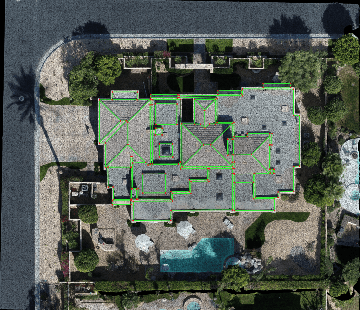
Aerial mapping offers a comprehensive overview of vast terrains and landscapes. Our advanced drone technology enables us to create detailed maps and 3D models for industries such as construction, agriculture, and environmental monitoring. With our aerial mapping services, you gain invaluable data for informed decision-making and strategic planning.
Drone Surveying: Precision and Efficiency Combined
Drone surveying brings together precision and efficiency, allowing us to conduct topographic surveys and land assessments with unparalleled accuracy. Our drone surveying services expedite the data collection process, delivering cost-effective and time-efficient results that empower your project’s success.
Drone Filming: Cinematic Storytelling from the Sky
Drone filming opens up endless possibilities for cinematic storytelling. Our skilled drone pilots and cinematographers collaborate to produce visually captivating sequences that add depth and drama to your visual projects. From breathtaking action scenes to serene aerial shots, our drone filming services enrich your narratives with a touch of magic from the sky.
Aerial Cinematography: Artistry and Technology United
Aerial cinematography represents the fusion of artistry and technology. Our expert team combines their creative vision with cutting-edge drone technology to produce cinematic masterpieces that leave a lasting impact on your audience. Whether you’re filming a commercial, a music video, or a documentary, our aerial cinematography takes your project to new heights.
Drone Footage: Transforming Ideas into Reality
Drone footage breathes life into your ideas, transforming them into captivating visual content. Our team of skilled drone pilots and videographers work closely with you to understand your vision and bring it to life with stunning aerial footage. Whether it’s for advertising campaigns or personal projects, our drone footage showcases your ideas in their best light.
Drone Mapping: Precision Data for Informed Decisions
Drone mapping provides precise data for informed decisions across various industries. Our advanced drone technology creates detailed maps, orthomosaic images, and 3D models that offer a comprehensive understanding of your project’s terrain. With our drone mapping solutions, you gain valuable insights that shape the success of your endeavors.
Drone Solutions: Tailored to Your Needs
At Drone Imagery, we believe in delivering solutions tailored to your unique needs. Our custom drone solutions cater to a wide range of industries and applications, ensuring that every project receives the attention and expertise it deserves. From concept to execution, our team collaborates with you to achieve outstanding results that surpass expectations.
Aerial Data: Empowering Data-Driven Decisions
Aerial data provides valuable insights that empower data-driven decisions across various sectors. Our expertise in aerial imaging and data analysis offers a deeper understanding of your projects, enabling you to make informed choices and optimize your operations. Let our aerial data services be the key to unlocking your project’s full potential.
Drone Technology: Pushing Boundaries, Delivering Excellence
Drone technology is at the forefront of innovation, pushing boundaries and opening new possibilities in various industries. At Drone Imagery, we stay at the cutting edge of drone technology, ensuring that our services are always up-to-date and deliver excellence in every project. Trust us to harness the power of drone technology to elevate your vision to new heights.
Aerial Media: Visual Storytelling That Soars
Aerial media encompasses visual storytelling that soars to new heights. From photography to videography, our aerial media services present stunning visuals that captivate your audience and communicate your message with unparalleled impact. Elevate your visual storytelling with our aerial media services and leave a lasting impression on your viewers.
Drone Capture: Moments Frozen in Time
Drone capture freezes fleeting moments in time, preserving memories that transcend the ordinary. Whether it’s a special event, a milestone celebration, or a memorable occasion, our drone capture services immortalize these precious moments with stunning aerial visuals. Let us be the storyteller of your memories, capturing every detail from above.
Aerial Visuals: Beauty from the Sky
Aerial visuals present beauty from an entirely different perspective. Our skilled team of drone pilots and photographers captures awe-inspiring aerial visuals that showcase the world’s natural wonders and architectural marvels from above. Experience the beauty of the world through our lens, and let our aerial visuals inspire wonder and appreciation.
Drone Shots: The Perfect Frame from Above
Drone shots offer the perfect frame from above, capturing scenes that are both cinematic and breathtaking. Our team of experienced drone pilots ensures precision in every shot, delivering visuals that leave a lasting impression on your audience. From marketing campaigns to film projects, our drone shots add a touch of magic to your visuals.
Aerial Perspectives: Seeing the World from New Heights
Aerial perspectives allow you to see the world from new heights, unveiling hidden beauty and undiscovered treasures. Our drone services provide unique perspectives that transform your projects, offering fresh and captivating viewpoints that resonate with your audience. Let our aerial perspectives be the key to unlocking untapped potential in your endeavors.
Drone Survey: Efficiency in Every Detail
Drone survey offers efficiency in every detail, enabling accurate and comprehensive data collection. Our drone surveying services streamline the survey process, delivering results with unrivaled precision and speed. Experience the power of drone technology in surveying, and witness how it transforms the way you approach projects.
Aerial Views: A New Outlook on the World
Aerial views provide a new outlook on the world, unveiling stunning vistas and captivating landscapes. Our aerial photography and videography services capture these views with exceptional clarity and artistry, allowing you to experience the world from a different perspective. Embrace the beauty of aerial views, and let us elevate your vision to new heights.
Drone Photography Services: Expertise that Soars Above
Our drone photography services are backed by expertise that soars above the rest. With a team of skilled pilots and photographers, we deliver images that stand out and resonate with your audience. Whether it’s for marketing campaigns, real estate listings, or personal projects, our drone photography services promise excellence in every frame.
Aerial Photography Company: Your Trusted Partner in the Sky
As an aerial photography company, we are your trusted partner in the sky. With a proven track record and a commitment to quality, we deliver exceptional aerial imagery that meets your goals and exceeds expectations. Partner with us, and experience the power of aerial photography in transforming your visual projects.
Drone Video Services: Visual Storytelling at Its Finest
Our drone video services offer visual storytelling at its finest. With a focus on creativity and precision, we craft videos that engage, inspire, and resonate with your audience. From concept to post-production, our drone video services ensure that your story comes to life in an immersive and captivating way.
Aerial Imaging Solutions: Precision and Possibilities Combined
Aerial imaging solutions offer precision and possibilities combined, unlocking new potentials in various industries. Our expertise in aerial imaging and data analysis delivers insights that empower your projects and initiatives. Discover the power of aerial imaging solutions and transform your ideas into reality.
Drone Inspection Services: Safety, Efficiency, and Accuracy
Drone inspection services prioritize safety, efficiency, and accuracy in every task. Our drones navigate hard-to-reach and hazardous areas, providing visual data without risking human safety. From infrastructure inspections to industrial assessments, our drone inspection services ensure a detailed and reliable evaluation.
Aerial Mapping Services: A Clear Path to Success
Aerial mapping services offer a clear path to success, providing detailed insights for your projects and endeavors. Our advanced drone technology creates high-resolution maps and 3D models that guide your decision-making and optimize your operations. Experience the power of aerial mapping services and embrace a strategic approach to your ventures.
Conclusion
Drone Imagery is your premier destination for exceptional aerial photography and videography services. Our team of skilled professionals is dedicated to capturing breathtaking visuals from above, offering unique perspectives that elevate your vision to new heights. With a wide range of drone services, including aerial photography, drone videography, aerial mapping, and drone inspection, we cater to various industries and applications. Trust us to harness the power of drone technology and unleash the potential of aerial imagery for your projects. Let us be your partner in creating captivating visual content that leaves a lasting impression on your audience. Explore the possibilities with Drone Imagery and take your projects to new heights of excellence.
Drone Survey Inspections
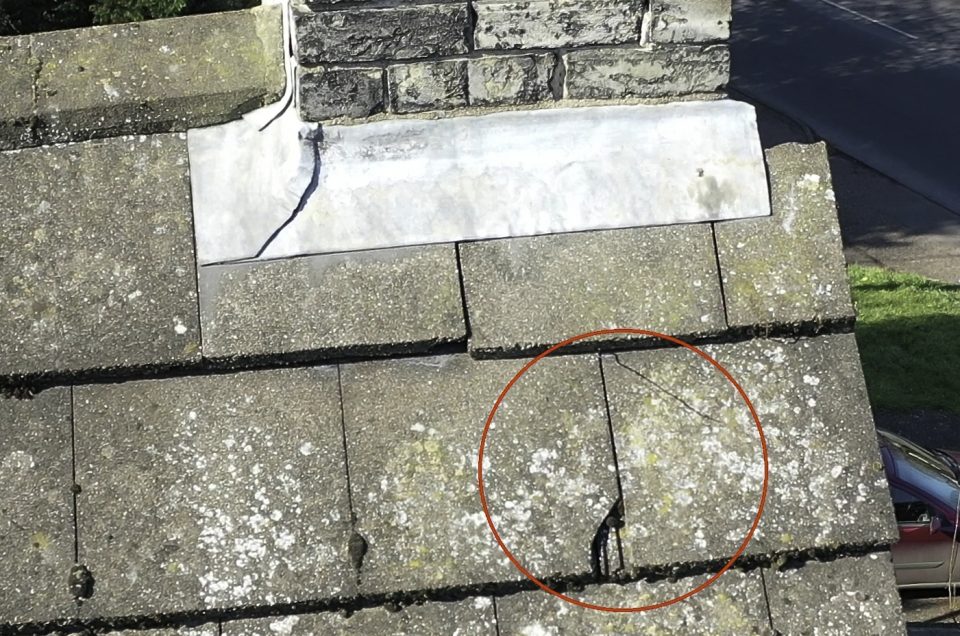
Drone Imagery are specialists in any height aerial building surveys, producing aerial video and stills and inspections on chimney structures, towers and roofing for commercial applications using radio-controlled drones (UAV’s).
For instance, we do work for leasehold tenants, property owners, consultants, chartered surveyors, local councils, and buildings for churches. In addition, our projects include listed buildings, retail parks, churches, industrial estate sites, solar farms, towers, wind turbines, and landmark buildings.
All of Drone Imagery pilots are CAA approved and are skilled in flying, this is important for aerial survey drones to get a view of those “awkward” places.
Above all, we can fly our drones close to the roof or building, this part of the job and when done correctly, we can capture detailed aerial images at 22 megapixels or with our ultra-HD 4K camera video footage.
VALUE OF DRONES FOR ROOF INSPECTIONS
- Identify and map heat loss or pooling water in roofs
- Perform energy audit inspections for thermal insulation efficiency
- Detect thermal hotspots within walls from faulty electrical circuits
- Gain insights safely and efficiently from above
In conclusion, we can facilitate imagery in places others find it hard to do so.
Precision Agriculture
Until now farmers have spent hours visualizing data from the ground level on quad bikes or from tractors. This gives them fairly limited information about the condition of the crop as a whole.
However, with our agriculture drones (UAV’s) it is now less time consuming to view any given land area and turn it into actual data in a few hours. Precision agriculture is much more affordable using drone technology.
In addition, drone Imagery’s commercial quad-copter drones can fly an average of 60-80 acres in around 20 minutes without the need to land. We carry spare pre-charged batteries on each job. It only takes a few minutes to change the battery and get back in the air. So we are able to fly all day with very little disruption.
Drone Imagery has drones specific for agriculture have modified drone cameras to produce NDVI imagery.
In other words, by data mapping your land, you can anticipate yields.
In conclusion, by gathering data on such things as moisture content of the soil, drainage, and patches with less or more growth. Armed with this data you can decide what crops will grow better in which fields, and which seed varieties suit best.
Engineering Surveys
Drones mean a quantum leap for surveying. Therefore, they provide eyes that can reach and hover above specific sites.
Their height and cameras can be adjusted remotely. Equipped with sensors, they can measure, transmit, and store data.
For instance, global positioning has created greater interest in Geographical Information Systems (GIS). According to Drone Analyst, “GIS professionals provide a wide variety of land-related services.
Above all identifying property boundaries, subdividing land, and surveying construction sites for placement of buildings.
In addition, they also produce topographic and hydrographic maps, volumetric calculations for stockpiles. Similarly for flood insurance maps, among other services.”
Solar Panel Inspection
Over the last 10 years, the market for Solar Panel systems has grown tremendously.
In Europe alone, over 1 million photovoltaic systems were installed at the end of 2019.
Considering the amount of maintenance that’s needed for such a high number of panels, in other words, there is a need for efficient quality survey tools.
Above all, it’s the inspection of solar panels, which is of high importance to guarantee life long operation of the panels. This is the basic requirement for efficient solar electricity generation, so we get a long period of operation and fast return for your investment.
Drones that use thermal imaging cameras provide several advantages. The most important are for example – hot spots can be seen very clearly on a thermal image in contrast to other methods that take more time to complete thermal imaging cameras can be used to inspect the solar panels, while they are still in the circuit and operating.
In conclusion, the inspection doesn’t mean downtime.
VALUE OF DRONES FOR SOLAR FARM INSPECTIONS
- Rapid and Easy scans for Rooftops and arrays
- Hot spot identification showing defective cells / Geo-tagged image
- Diagnostic purpose/planning of Panel placement
- Infrared signatures show defective panels
- Keep the solar farm running at peak efficiency
- Save time with pre-selected waypoint aerial inspections
Drone Wedding Photography / Video
Land-based wedding photography has been the traditional method for many years and is great, but why not consider aerial photography and video?
Therefore, why not consider giving your wedding guests a nice surprise and create memories that you’ll never forget.
If you’re getting married, for instance, combining your land-based wedding photographs with some amazing aerial shots using a drone.
However, our drone pilots have experience at capturing special moments without being intrusive, as people gather we can take photos.
This creates a whole new perspective for your wedding photos this will give your guests something to talk about for a very long time.
In addition, you will get a birds-eye view of your venue and guests with natural shots that will enhance any wedding album. We can produce a book from the images we take.
Create a wedding with a difference, add drone photography to your wedding photography after all you only get married once.
In conclusion, Drone Imagery offers affordable wedding package imagery that can include drone photographs and video if you so desire, for your wedding ceremony, and at the reception. Find out more about our aerial photography package we offer.
Drone Event Photography / Video
What’s the next great event happening in your life? Drone Imagery looks forward to the opportunity of capturing true life moments by means of their Event Videography services.
Our Event Video Production capabilities allows us to film the event or story as it unfolds. We are here to support your special event with Video Production Services at your upcoming anniversary, birthday bash, baby shower, and celebration of life gathering! We connect with our clients and listen to the flow of their event.
This event video production process keeps us accountable, to accommodate the clients needs, and be there for all the specific moments that define their untold story. After that our team of videographers captures cinematic style content with our 4K industry standard equipment.
4K Video Production equipment allows for a significantly sharper video resolution and the highest level of sound quality, however we can shoot in your desired frame rate.
Your Event Videography project comes alive in the editing phase, where we implement music, graphics, and inspiring visuals. All these parts of the storytelling process will communicate your Event Video Production message with a deep emotional impact. To find out more please give us a call or send us an email so we can schedule a meeting.
Promotional Videos & Stills
Promotional videos are an essential aspect of digital marketing, especially in the age of social media.
We have the equipment, applications, and the expertise to capture and produce eye-catching, informative, entertaining short films promoting or documenting your business, service, product, or event.
In addition, Drone Imagery can publish it online for your convenience, after that, you can decide how we can fine-tune for your business needs. In other words, a mix of aerial and ground visuals will make your video unique but then we throw Virtual Tours & 360 Panoramas into the mix and you have a powerful marketing package, above all, your promotional package stands out from the competition.
Email: info@drone-imagery.co.uk
FB: https://www.facebook.com/DroneImageryPro
Twitter: @droneimageryuk
Instagram: droneimagerypro
